View more topics under
Land and Space
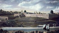
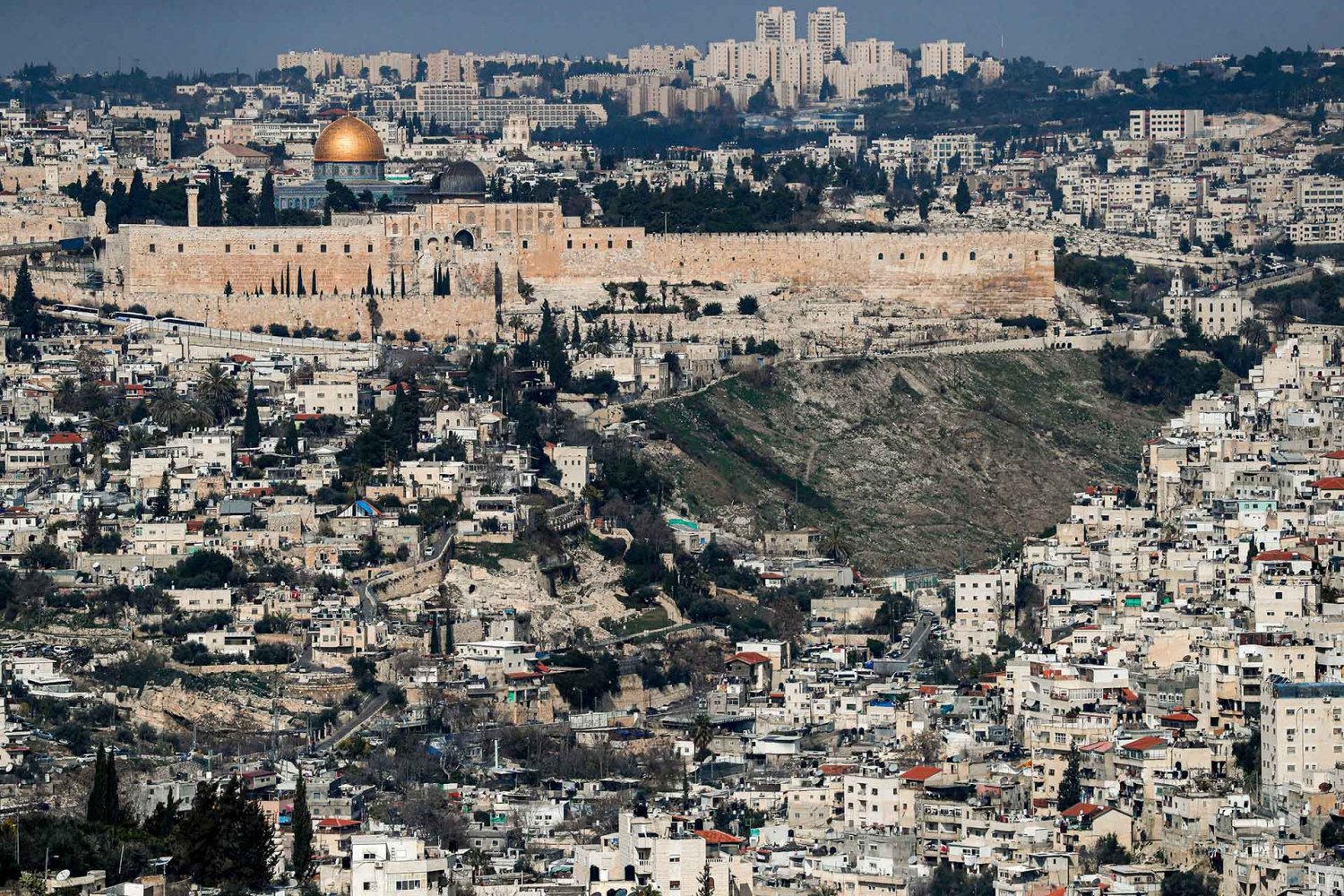
A view of the Old City of Jerusalem, including the Haram al-Sharif compound and Silwan, from Jabal Mukabbir, January 28, 2020

Credit:

Ahmad Gharabli/AFP via Getty Images

Journal Article

Silwan, the Bleeding Wound

Snapshot

Silwan, a large ancient Palestinian neighborhood immediately south of the outer walls of Jerusalem’s Old City, has been the site of an ongoing Zionist settlement campaign using all of the diverse tools of demographic displacement. This article draws a general picture of Silwan and its various subdivisions, including the mechanisms of displacement used in each one. The article, translated from Arabic by Aline Bazouni, was published in English in the Jerusalem Quarterly, no. 93 (Spring 2023): 100–122, and is reproduced here verbatim by permission from the publisher.

Recently, media coverage has been extensive about Zionist attempts to uproot Palestinian residents from a targeted section of the Sheikh Jarrah neighborhood in Jerusalem, to make way for its colonization by settlers. There are multiple reasons why local and international media have focused on the Sheikh Jarrah colonization efforts. What is happening—the uprooting and displacement of Palestinian refugees for the second time—is related directly to refugees’ right of return. The plethora of foreign institutions and consulates based in Sheikh Jarrah meant that the issue of the neighborhood garnered special international concern. The social and cultural environment of the neighborhood is likely a major reason behind the ability of residents to be heard when they raise their voices and organize protests to appeal to the media. We bring up the issue of Sheikh Jarrah, which we have dealt with before extensively,1 as a complementing and contrasting counterpoint to the situation that another Jerusalem neighborhood—Silwan—has been living through for decades.

It is not possible to understand what is happening in Silwan in isolation from the overall battle for survival being waged ceaselessly throughout Old Jerusalem, inside and outside its walls. Certainly, it is also broadly related to the survival of the city’s identity and culture, and the outcome will determine its future. Silwan’s situation encapsulates all control of space strategies and tools used to manipulate the population and influence demographics. It clearly demonstrates the battle of existence by the indigenous population against the armed occupation forces who use a seemingly limitless array of tools that were conjured before and after the Israeli occupation in 1967 to achieve their settler-colonial goals.

This article will attempt to draw a general picture of Silwan, with its various subdivisions, and focus on the motives and mechanisms of settler colonialism therein, and its impact on Silwan, and on Jerusalem in general.

Interview Rereading Jerusalem’s History

Palestinian Jerusalemites view the history of their city through a different lens. A conversation with Palestinian historian Nazmi Jubeh.

It is not possible to understand what is happening in Silwan in isolation from the overall battle for survival being waged ceaselessly throughout Old Jerusalem.

Silwan and Its Neighborhoods

Silwan, the village just outside the walls of the Old City of Jerusalem, constitutes an important part of the history of ancient Jerusalem (seen in the archaeological site Talat al-Duhur) and the walled city, where the ruins of ancient Jerusalem are located. Here I will not retrace the history of Silwan, but Silwan village was built on the slopes around the Silwan spring, the only water source in Jerusalem, and the irrigation source for the crops in the valleys. The village structures were built on the western slope of Ras al-‘Amud hill, less than four hundred meters from the eastern wall of the Old City. Arab historians and geographers mention Silwan as “a locality” in the city of Jerusalem in the 10th century CE —not a date for the establishment of Silwan, but confirmation that Silwan was at that time a significant village. The lands of Silwan village were adjacent to the walls of Jerusalem from the eastern and southern sides, extending eastward to the borders of al-‘Ayzariyya (Bethany) and Abu Dis, with lands stretching even beyond them in the east toward the Jericho road. On the western side, the lands of Silwan extended to the northern slopes of Jabal al-Mukabbir and reached the eastern slopes of Jabal al-Nabi Dawud (Jabal Sahyun/Mount Zion). Silwan lands are also located on the southeastern slopes of Jabal Zaytun (Mount of Olives). An important portion of Silwan lands, especially Wadi Hilweh, was located within the walls of Byzantine Jerusalem from the 5th century CE until the end of the Fatimid period, in the 11th century CE, when the areas of the walled city were constricted to approximately their current location. The areas outside the walls were used as agricultural lands belonging to the village of Silwan.

Sixty families resided in Silwan in 1596.2 Its population consisted of about ninety-two families in 1870 and by the end of the 19th century it had reached about a thousand people.3 The British Mandate census in 1922 shows that the population of Silwan increased to 1,901 inhabitants.4 The population growth continued steadily, reaching 2,968 people living in 630 houses in 1931.5 In the 1945 census, the population of Silwan reached 3,820 people.6

Silwan village was built on the slopes around the Silwan spring, the only water source in Jerusalem.

Silwan in 1873 from a scale model map prepared by Stephen Illés

Figure 1. Silwan in 1873, from the scale model of Jerusalem prepared by Stephen Illés, currently on display in the Citadel Museum in Jerusalem

Source: 

From Rehav Rubin, “Stephan Illes and His 3D Model-Map of Jerusalem (1873),” Cartographic Journal 44, no. 1 (2007): 71–79. Open Source.

Silwan remained a beautiful village consisting of rows of houses perched on rocky contours at the foot of the mountain, outside the boundaries of the British Mandate’s municipality of Jerusalem. It stayed as such until it was annexed to the Jordanian municipality of Jerusalem in 1961. Silwan grew rapidly during the second half of the 20th century. The population of Jerusalem increased dramatically, which led to the overcrowding of the Old City. This in turn prompted the construction of new buildings on the various lands of Silwan and the movement of residents from walled Jerusalem to areas of Silwan, especially al-Thawri and Ras al-‘Amud, but also toward the Wadi Hilweh and Batn al-Hawa neighborhoods. This movement gained significant momentum after 1961 when Silwan became part of the Jordanian municipality of Jerusalem.

Despite the expansion that Silwan witnessed during the British Mandate period, evident in the population statistics, a larger population increase and the acceleration of the construction process in Silwan took place after 1967, when lands were confiscated all over Jerusalem, and the [Palestinian] population was restricted to specific areas. This increase in pressure on Silwan, being very close to the Old City, left no empty lands remaining there; all agricultural lands gradually disappeared, especially the orchards directly south of the Old City, known as al-Bustan. Most of the neighborhoods in Silwan grew haphazardly, without infrastructure and without planning, and in very complex social and economic conditions.

Today, by simply wandering in the alleys of Silwan neighborhoods, it is readily apparent that most residential buildings are unfit for human habitation; the buildings are extremely overcrowded, confined to narrow spaces, and built on top of one other [sic] without the minimum conditions for healthy housing. The vast majority of Silwan residents live below the city’s poverty line, and diseases related to poverty prevail in their neighborhoods. Today Silwan, with all of its various historical neighborhoods, is home to an estimated 60,000 people: it is one of the cities that make up Jerusalem.

Today Silwan, with all of its . . . historical neighborhoods, is home to an estimated 60,000 people.

Silwan is considered an integral neighborhood of Jerusalem, the southern flank of Old Jerusalem, adjacent to the southern wall of al-Aqsa Mosque. It embraces the Old City from the southern and eastern sides, and hosts the site of the ruins of ancient Jerusalem, an area misleadingly called the “City of David.” Silwan is also considered the main element of the so-called Holy Basin. Due to its important location, Silwan is the target of a fierce settlement campaign.

The settlement drive in Silwan takes the various forms that have been used in the settler-colonialization of all of Palestine. Indeed, there is no colonial law for direct or indirect ways to seize, appropriate, and control property and lands from under the feet of their owners that has not been used in Silwan.

Below, I will try to describe in brief the situation of the different areas of Silwan, based on the local names of each neighborhood, with a focus on settlement activities taking place there. Although each area requires a detailed survey, the aim here is to present a comprehensive picture. The geographical boundaries of each component will be put forward in general terms only, since no clear boundaries exist. Due to the lack of previous detailed studies, the author will also draw on his rich memories of Silwan, where he resided for a significant period of his life before and after 1967.

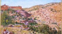
An 1854 drawing of Jerusalem’s Holy Basin by English painter Thomas Seddon, showing the Old City and the valley to its east
Backgrounder What and Where Is Jerusalem’s Holy Basin, and Why Is It So Significant?

Jerusalem’s Holy Basin is a microcosm of Israel’s settler-colonial agenda in the city and the country.

A map depicting approved Israeli plans the center of Silwan, a Palestinian neighborhood in Jerusalem

Figure 2. Part of the Silwan neighborhood and Israeli plans

Source: 

From Bimkom, “Silwan Center – Approved Plans in the Neighborhood,” 2013

Wadi Hilweh

This Silwan neighborhood is located to the south of the Ottoman walls of Jerusalem. It begins outside Bab al-Maghariba (Silwan Gate/Dung Gate) and extends south to reach what is now known as al-Bustan neighborhood. In the east, it reaches Wadi Sittna Mariam (Valley of Our Lady Mary/Kidron Valley) and on the west, Jabal al-Nabi Dawud (Jabal Sahyun/Mount Zion). Until 1967, several dozen houses were spread out on both sides of the valley and some on the western slope of Jabal al-Nabi Dawud. Agricultural lands occupied the largest area of the neighborhood; its population totaled less than two hundred. The site of ancient Jerusalem, the spring, and the pond of Silwan were essential components in forming the neighborhood, hence the historical and symbolic importance of Wadi Hilweh.

Wadi Hilweh Information Center

A community initiative confronting Israeli efforts to erase the history of Silwan

The site of ancient Jerusalem, the spring, and the pond of Silwan were essential components in forming the neighborhood.

Today, Wadi Hilweh has an estimated population of about 6,000 inhabitants.7 Most of its homes were built without a permit, due to the suspension in issuing licenses during and since the British Mandate period, except in rare cases. Plans to transform the area into a swath of natural and archaeological parks continue to this day.8 Yet despite the many British, Jordanian, and Israeli plans for the area, the neighborhood continued to grow steadily; these residents of Jerusalem imposed a status quo on the ground, without regard to others’ “official plans.” The neighborhood attracted residents, especially during and after the British Mandate period, because it was attached to Old Jerusalem, and residents did not need transportation to access the walled city, which they considered to be their center of life. From the neighborhood, the muezzin calls to prayer at al-Aqsa Mosque could be heard clearly. Today, as a result, buildings are crowded throughout the neighborhood, poor housing and signs of poverty are obvious everywhere, and the neighborhood lacks basic infrastructure, parking, and spaces between the buildings.

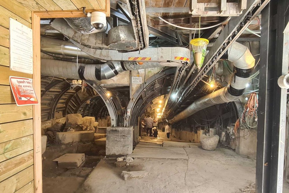
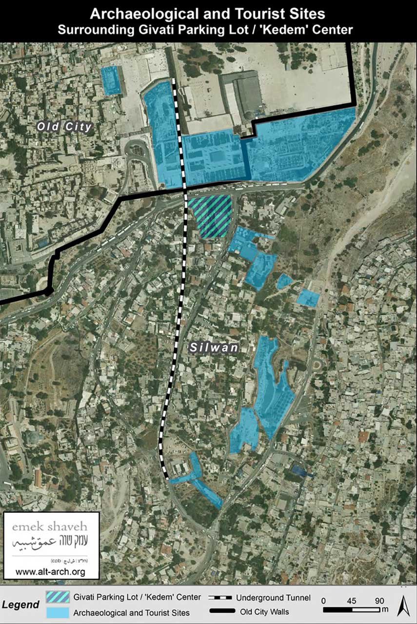
Interest in the Wadi Hilweh neighborhood became keen in the second half of the 19th century, when biblical archeology schools began seeking ancient Jerusalem linkages to bolster a biblical narrative. The archaeological hill in Silwan (Talat al-Duhur/Ophel), named the “City of David,” became so famous that excavations soon spread to nearby areas. They took on organized forms after 1923 at the hands of international specialists and amateurs fascinated by biblical narrative–based archeology.9 These excavations continue today, extending from the southern wall of al-Aqsa Mosque to continue the excavations where Umayyad palaces were located,10 through extensive excavations in a plot known as the parking lot of Wadi Hilweh (the Israeli “Giv’ati parking”),11 all the way to the Silwan pond and its surroundings. On the eastern side, the excavation area extends to Wadi Sittna Mariam and passes through the new tunnel dug three to four meters under the street and buildings of Wadi Hilweh, from the Silwan pond to inside the walls.12

Palestinian neighborhoods of Silwan and the Mount of Olives above
Feature Story Israeli Government Pumping Millions into Rebranding the Holy Basin, Erasing Palestinian Heritage

Israel is spending millions on a Judeo-centric “Jerusalem Heritage” program for the Holy Basin.

The eight-meter-wide tourist double tunnel under the Wadi Hilweh area of Silwan, East Jerusalem

Figure 3. The eight-meter-wide tourist double tunnel under the Wadi Hilweh neighborhood

Source: 

emekshaveh.org/en/biannual-summary-2022/ (accessed March 14, 2023)

To the south of al-Aqsa Mosque, a large tourist center was established for an estimated half a million visitors annually, most of whom are Israelis. The center puts forward a Jewish history of the region through inventive films, models, and sound and light shows, even if the results of the excavations do not support this narrative (there is near unanimity among serious researchers, including large numbers of Israeli historians and archaeologists, that the difference between the results of the archaeological excavations and the biblical narrative is vast). Elad, the Hebrew acronym for Ir David (City of David Foundation), a militant settler organization, was given the license to operate the entire site by the Israeli government.13 It is the only “park,” natural or archaeological, managed by a nongovernmental organization instead of the Israeli Nature and Parks Authority. Elad is also the main funder of the excavations that take place in that area, including the digging of the wide tunnel under Wadi Hilweh.

The Israeli attempts to take control of Wadi Hilweh and rename it Ir David (City of David), using legislation and more direct methods, relied on six simultaneous strategies. The first was to control the archaeological sites: the archaeological Silwan hill, spring, and pond and their wide surroundings; the car park mentioned earlier, and its extension to the southern walls of the Aqsa Mosque; and the new tunnel dug under Wadi Hilweh.14 All were placed under the administration of Elad F, making the latter a kind of local government within its areas of control, a move unacceptable even to a large number of Israeli archaeologists. The second plan relied on having each area of Wadi Hilweh (along with other parts of Silwan, as is explained in subsequent sections) designated a “national park.” A third plan involved claiming property associated with Jewish occupants prior to 1948; several properties that met the Israeli definition were found and transferred to Elad. The fourth route was to purchase or control real estate through brokers, searching for any legal loopholes or social problems, or resorting to forged documents, to undermine Palestinian ownership of property. Lawyers whose sole task is to search for mechanisms to control property in Wadi Hilweh do full-time work for Elad Foundation. A fifth mechanism was to focus on taking over the property of Palestinian absentees, defined as Palestinians who were not present in Jerusalem in June 1967. This definition applies to many lands, whether the absentees are the sole or partial owners of a property, whether they reside outside Palestine or only outside the Israeli-defined Jerusalem municipal boundaries. The combination of these activities enabled the various branches of the Israeli occupation to control many properties in Wadi Hilweh.

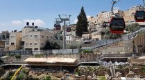
The cultural landscape of the northern part of Wadi Hilweh will be transformed after Israel establishes its cable car project, which has already acquired the necessary Israeli licenses. This project is now in the final stages of planning. The Israeli Supreme Court gave the green light for its implementation on May 15, 2022, rejecting all objections. It is not known when it will be fully implemented.15

The number of properties that Elad Foundation managed to control and register in its name in Wadi Hilweh is not known with certainty, since not every transaction that takes place is transparent. A case may arise after many years, when the Palestinian owners find that their property was silently taken over years before without them knowing. Elad announces “in due course” the control of the property, and then the residents find themselves evacuated by the police. They must go to the Israeli courts to try to prove the invalidity of Elad’s control over their property. The court cases extend over years, come at high costs, and rarely end in favor of the Palestinians. Today, the number of Jewish settlers in Wadi Hilweh is estimated at 350, about one-third of the total number of settlers in all of Silwan.

Cable car route over Palestinian homes in Wadi Hilweh, Silwan, in East Jerusalem
Feature Story Controversial Cable Car Project Sparks Outcry as City Orders Land Expropriation from Silwan Residents

The city notifies Silwan residents of its planned confiscation of private lands as cable car project gets underway.

Aerial photo showing Israeli archeological excavations in Wadi Hilweh, Silwan, East Jerusalem

Figure 4. An aerial photo showing the neighborhood of Wadi Hilweh, the locations of the excavations, and the land under Israeli control in the name of archaeology, in Wadi Hilweh. Circled in red is the archaeological hill of Silwan which Israelis control.

Source: 

emekshaveh.org

Today, the number of Jewish settlers in Wadi Hilweh is estimated at 350, about one-third of the total number of settlers in all of Silwan.

Wadi al-Rababa

Wadi al-Rababa is the natural extension of Wadi Mamilla, which begins at the Mamilla cemetery, west of Bab al-Khalil (Jaffa Gate). That valley continues along the western wall of the Old City, forming first the huge Sultan’s Pool, then runs east at the so-called Jurat al-‘Inab with a steep slope, where it is called Wadi al-Rababa (Hinnom Valley). Part of the western side of Wadi al-Rababa is located inside the 1949 Jordanian-Israeli armistice demarcation or Green Line; the main part of the valley up to al-Bustan neighborhood in the southeast was occupied in June 1967. Wadi al-Rababa is bordered on the south by al-Thawri neighborhood (part of Silwan) and on the north by Jabal al-Nabi Dawud (Mount Zion) and Wadi Hilweh.

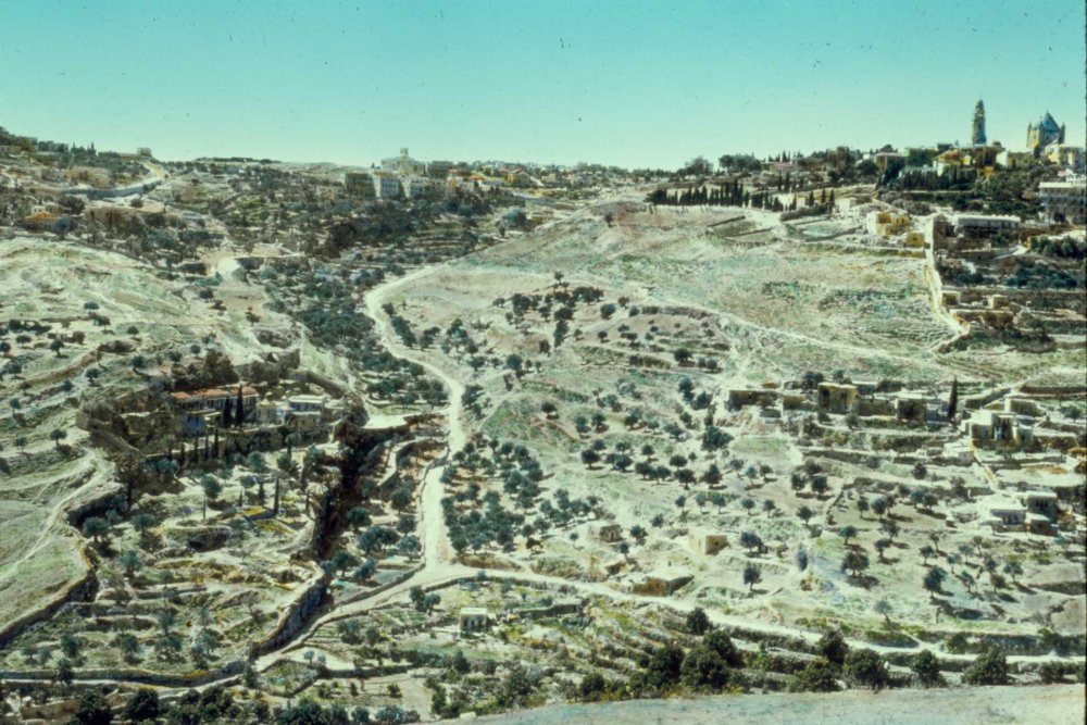
Wadi al-Rababa has a beautiful geological landscape, nestled between two rocky cliffs before sloping sharply to the southeast, and is filled with olive groves belonging to the inhabitants of Silwan. Some of the trees now stand untended where owners have been denied access to care for them. The lush greenery of Wadi al-Rababa links with the orchards of al-Bustan neighborhood and provides a natural park for the residents of Wadi Hilweh and al-Thawri neighborhood, as well as for other residents of Jerusalem. On the northern end, some Palestinian houses belonging to Wadi Hilweh overlook the valley, although they are geographically closer to Wadi al-Rababa.

The valley was famous in ancient times for its natural caves, used by Jerusalem residents to bury the dead. Over the ages, additional burial caves were carved out of the hills. The graves date back to the Roman era and extend to the Mamluk period, facilitating the claim for control by the Israeli Antiquities Authority over an important part of the valley by declaring it an archaeological site. At the northern end of the valley, the graves of a small Jewish cemetery were renovated in the last three decades; the cemetery was also expanded to a much larger area than its original size by the addition of new tombs planted on it to control more land, thus preventing the urban expansion of nearby Silwan inhabitants. These homes are now threatened with demolition or takeover, as they lie near an archaeological site and a Jewish cemetery. At the southeastern end of the valley sits the Greek Orthodox Monastery of Aceldama (also called Saint Onuphrius Monastery), built in 1874 on the ruins of a 4th-century Byzantine church.

To facilitate Israeli control of Wadi al-Rababa, some lands were declared absentee property, based on the fact some of the owners—although a minority—were absent from Jerusalem in 1967. As for the rest of Wadi al-Rababa’s lands, which are owned by Jerusalem residents with deeds proving their ownership, they were confiscated anyway to form part of a “national park” to be established as a belt around the Old City and as part of the Old City (Holy) Basin.16 The Israeli municipality of Jerusalem issued a decision to confiscate 60 dunums of the land in 2018. This decision should not be viewed in isolation from the other means of takeover, which are listed below. However, it is important to look at the seizure of Wadi al-Rababa as only one effort by Israel to control the cultural landscape and marginalize the Palestinian presence as much as possible, with the end point—using the massive tools in their arsenal of control—being to erase the whole of the cultural landscape.

Short Take How Israel Applies the Absentees’ Property Law to Confiscate Palestinian Property in Jerusalem

Israel uses the 1950 Absentees’ Property Law and several amendments to it to confiscate Palestinian property across East Jerusalem and give it to Jewish settlers.

Wadi Rababa, Silwan, between the al-Thawri and al-Nabi Dawud neighborhoods, ca. 1940

Figure 5. Wadi al-Rababa, from the east, circa 1940: to the left the monastery and above it al-Thawri neighborhood; to the right, al-Nabi Dawud neighborhood

Credit: 

Library of Congress, Prints and Photographs Division [LC-DIG-matpc-22741]

Wadi al-Rababa separates Wadi Hilweh and al-Thawri (Abu Tur), precluding physical and urban communication between the two neighborhoods and constituting a barrier to the movement of residents in the area. Its use by Palestinians as a park has become very limited after several Palestinian buildings located at the top of the valley on the western side—designated no-man’s land after 1948—were converted into an Israeli cinematic club. Additionally, a settlement was planted between al-Thawri neighborhood and the valley, and directly connected by a street. The Elad Foundation, in partnership with the Israeli Nature and Parks Authority, organizes courses on “biblical agriculture” in the valley, presenting a Palestinian tabun (traditional oven) that they constructed on the site and a display of agricultural tools to represent life in the area 2,000 years ago, using expansive imagination. A significant area of the valley was fenced off with a metal barrier to serve as an open-air biblical museum, encouraging tourists to visit and Judaize the site. Today, a visitor can witness the extent to which Wadi al-Rababa has been fully controlled into yet another site for the biblical narrative, along with Wadi Hilweh, and areas of the Old City and its surroundings. Dozens of such museums have been built in Jerusalem and its surroundings for this purpose, almost all aiming to impose proof of the existence of a Jewish heritage in Jerusalem two thousand years ago.

Al-Bustan Neighborhood

Al-Bustan neighborhood, part of Wadi Sittna Mariam (Kidron Valley), is located southeast of Wadi al-Rababa and east of Silwan pond. Until the 1980s, it was a huge orchard with tall fig trees irrigated by the Silwan spring, interspersed with pomegranate trees and vegetables—radishes, onions, parsley, mint, and legumes. Many families of Silwan lived from their orchards, which provided produce that was part of the fresh food basket of Jerusalem.

The signs of today’s housing crisis began in Jerusalem in the 1970s, when vast areas of the city’s lands were confiscated. Most neighborhoods, including Silwan, lost their surrounding lands, confining any urban expansion to the available spaces inside these neighborhoods. Al-Bustan’s orchards began to gradually disappear to be replaced by buildings. The more intense Jerusalem’s housing crisis became, the faster the fig trees were replaced by buildings. By the 1990s, the orchard disappeared and was replaced by a full-fledged neighborhood, built, of course, without licenses, without planning, and without basic infrastructure. Over time, the neighborhood became overcrowded; some buildings expanded upward, rising two floors or more, as families grew. The number of houses reached ninety, while the estimated number of residents of the neighborhood was over 1,200, and perhaps as high as 1,500.

In this neighborhood, a different mechanism was used to control it: the idea was conceived that the site was a “garden” of King David in the 10th century BCE, called “Valley of the King.” On the pretext of this imagined garden, the geographical space should, therefore, be returned to the way it was in that era—the existence of which has never been proven in the first place. The Israeli projects related to it are all linked to the so-called Holy Basin. Although the neighborhood had fully developed under Israeli control in Jerusalem, under the watchful eye of its municipality and its various departments, the first Israeli reaction to the neighborhood’s existence came in 1995. At that time, the Jerusalem Tourist Development Steering Committee published a plan that included the establishment of an open museum on a site in the neighborhood, to celebrate the “three-thousandth anniversary” of the city of Jerusalem. Accordingly, the first version of the plan was prepared in 2000 and published in 2004. With this plan in place, the planning engineer of the Israeli municipality issued an order to demolish the “illegal construction” in the “Valley of the Kings,” and in the following year the municipality delivered demolition orders to the families living in the neighborhood and carried out the demolition of two homes.

Blog Post The al-Bustan Scout Troop Offers a Rare Respite for the Youth of a Traumatized Silwan Neighborhood

Children find joy, purpose, and belonging in scouting in al-Bustan, Silwan.

On the pretext of this imagined garden, the geographical space should, therefore, be returned to the way it was in that era—the existence of which has never been proven in the first place.

The residents of the neighborhood mobilized against this attack by forming a popular movement and organizing a series of protests that attracted wide attention, garnering solidarity at the local and international levels. The pressure prompted the Jerusalem municipality to postpone the remaining demolition orders, on condition that the residents settle the buildings’ legal status. Despite what some thought was a municipal game of “bait-and-switch,” the residents of the neighborhood invested large sums of money and duly submitted a structural plan in accordance with the urban planning principles followed in the rehabilitation of neighborhoods. Their proposal was summarily rejected in 2009. The District Planning Committee insisted that the neighborhood should be an open area devoid of buildings, due to its value. The municipality suggested that the residents of the neighborhood leave their homes and be relocated in the northern neighborhood of Beit Hanina, where it would provide buildings for them. The residents of al-Bustan neighborhood, however, rejected this offer and insisted on staying in their neighborhood.

The municipality suggested that the residents of the neighborhood leave their homes and be relocated in the northern neighborhood of Beit Hanina.

The al-Bustan neighborhood in Silwan, foreground; to the left, the Batn al-Hawa neighborhood

Figure 6. Al-Bustan neighborhood in Silwan, in the foreground, and to the left, the Batn al-Hawa neighborhood

Credit: 

Nazmi Jubeh

In the face of the residents’ staunch position, their continued sit-in in a tent they erected in the neighborhood, the considerable international solidarity for their cause, and the steady coverage of their story in the local and international media, the Jerusalem municipality modified its plan in 2010, offering to allow 66 houses on the eastern side of the neighborhood to be kept, after being rehabilitated, and to demolish 22 houses.17 On their ruins, a garden, artists’ workshops, souvenir shops, and cafes were planned to be built. Opposed to the break-up of their neighborhood, the residents presented an alternative scheme, which was rejected in 2011. The neighborhood continued protest activities until 2017. That year, the Jerusalem municipality issued demolition orders for five buildings, while demolition orders for another 28 buildings were prepared and not distributed, a tactic to avoid widespread backlash in favor of successive nibbling—the long game used in all Jerusalem neighborhoods.18

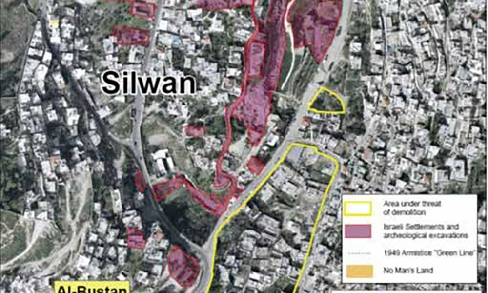
A map of al-Bustan neighborhood and the rest of Silwan neighborhoods showing the settlers’ control

Figure 7. Al-Bustan neighborhood and its relationship with the rest of Silwan neighborhoods, including Wadi Hilweh, showing the settlers’ control over the buildings in Wadi Hilweh, including archaeological sites [February 2009]

To this day, the threats to al-Bustan neighborhood are not over. The sit-in tent continues; despite having been demolished dozens of times, it is resurrected resolutely each time. The residents of the neighborhood still organize protest activities every Friday, and their tent has turned into a cultural center where residents gather and organize various activities. The residents are still holding onto their homes, rejecting the many offers made both covertly and overtly, becoming a kind of test ground proving the usefulness of mass struggle and popular resistance in protecting Jerusalem from the occupation’s designs.

Batn al-Hawa Neighborhood

Batn al-Hawa neighborhood is located on the southeast slope of Ras al-‘Amud to the east of al-Bustan neighborhood. It is an integral part of Silwan and is considered part of the well-known al-hara al-wusta (the middle quarter) neighborhood. In the 19th century, the site was part of Silwan’s agricultural lands and mostly used as pastureland for sheep and goats. It had a scattering of houses belonging to the people of Silwan.

The Jewish Yemenite settlement, Batn al-Hawa, Silwan, ca. 1890

Figure 8. The Jewish Yemenite settlement, Batn al-Hawa, Silwan, circa 1890

Blog Post In Batn al-Hawa, a Neighborhood Targeted for Forcible Expulsions, the Eyes Bear Witness

An art installation project in the Batn al-Hawa neighborhood of Silwan sends a message to the world.

A group of Yemeni Jews arrived in Jerusalem in 1881, totaling about 30 families from the city of San‘a’. They were likely motivated mainly by messianic religious reasons rather than consideration of any early Zionist motives. After completing their six-month journey, they found themselves not well received by the Jews of Jerusalem, either due to racial prejudice, since they looked dissimilar from Eastern (Sephardi) Jews and spoke an Arabic little understood even by Eastern Jews, or by their extreme poverty. They did not find a place in the Jewish Quarter in the Old City. Instead, it appears that they were expelled from the quarter, after Jewish religious leaders questioned their Judaic faith due to their different practice of the known rituals among the Eastern and Western Jewish sects. Some of these Yemenis found refuge in the foothills of Batn al-Hawa, where natural caves existed, including some ancient rock tombs. They lived there and were welcomed by the residents of Silwan, as was evident in a letter written by one of the members of this group in 1940.19 The rest of the group settled near Jaffa.

The second phase of their life was represented by the purchase by some wealthy Jews of five dunams in Batn al-Hawa to establish a Yemeni settlement, and the construction of one-room houses during the years 1885–91 to accommodate 45 families.20 At the end of the 19th century, the Yemeni community numbered about 200 people in the neighborhood. They lived in overcrowded and difficult conditions, with some of them continuing to live in caves, and depended on carrying water from Silwan spring. At the time, Jews referred to these dwellings as Kfar Hashiloach, meaning the village of Silwan, but the name “Yemeni neighborhood” or “the village of Yemen” prevailed among local residents. No problem emerged between this early settlement and the rest of Silwan’s residents, and they coexisted in relative peace. During the Buraq Uprising in 1929, the British Mandate police evacuated the Jews from the neighborhood, but after calm returned in the city, some returned to their homes. Soon after, the great Arab Revolt of 1936–39 erupted, and the British Mandate police ordered the remaining Yemeni Jews to migrate to western Jerusalem neighborhoods to reduce the risk of any direct friction, despite protest from the residents of Silwan and their commitment to protect their Yemeni neighbors.

No problem emerged between this early settlement and the rest of Silwan’s residents, and they coexisted in relative peace.

The condition of the buildings in the Yemeni neighborhood was dire; most collapsed in the 1940s. The Sephardic Jewish Committee, which oversaw the management of the Yemeni neighborhood, leased the rest of the small neighborhood to Silwani Palestinian Kayid Jalajil in 1946, for a period of three years. The Nakba intervened before the end of the contract, so Jalajil, in turn, rented or sold the remaining buildings to Palestinian families. The events of the Nakba and its aftermath maintained the case until 1967, since all property of Jews were registered with the Jordanian Custodian of Enemy Property, including the “Yemeni neighborhood,” without checking the actual ownership of the land.21 Some local stories recount that several houses had been sold to Palestinians, since a few Yemeni Jews had sold their homes after the events of 1929.22

Palestinians had also constructed buildings alongside those built for the Yemeni Jews. These expanded significantly after 1948, when the remaining buildings of the Yemeni Jews were inhabited by Palestinian families. The Palestinian construction expanded in the foothills of the mountain, linking Ras al-‘Amud and the historical root of Silwan, to al-Bustan area, also known as Bir al-Ayyub to the east of al-Bustan. Palestinian construction increased dramatically here too in the 1980s and 1990s, due to the housing crisis in Jerusalem. Gradually, the buildings of the Yemeni Jews disappeared due to their deterioration and the vertical and horizontal expansion in the surrounding area. Today, the neighborhood appears to consist of random blocks of cement, with the buildings slapped together without spaces between them. Access to most of the Batn al-Hawa neighborhood is by foot only, and severe poverty and ill health are prevalent among the residents.

Access to most of the Batn al-Hawa neighborhood is by foot only, and severe poverty and ill health are prevalent among the residents.

The first signs that Batn al-Hawa may become an issue surfaced in 1970, when the powers of the Jordanian Custodian of Enemy Property in East Jerusalem were transferred to the Israeli Custodian General, whose mission was to return Jewish property to Jewish owners. Most demands by Jews to recover their property were facilitated in the eastern part of the city, including the Old City, Wadi Hilweh, Sheikh Jarrah, Ras al-‘Amud, and other neighborhoods near and far from the Old City. However, no action was taken by any official Israeli authority in Batn al-Hawa—the heirs of the Yemeni Jews have not claimed any rights, and the neighborhood was not mentioned until the end of 2000.

The second step came when members of Ateret Cohanim, an extreme religious-nationalist settler organization, were appointed in 2002 as trustees of the Benvenisti Trust, which claimed ownership of 5.2 dunams in Batn al-Hawa, the site of the dwellings of Yemeni Jews.23 With this step, the matter moved from being a property claim into a settlement case. In that same year, requests were submitted by Ateret Cohenim to the Israeli court to evict Palestinian families from the neighborhood.

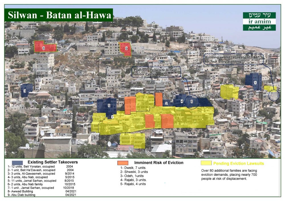
After learning eventually that the cases had been moved to court, the residents of the neighborhood worked on preparing a lawsuit against their eviction. The 2018 lawsuit against their eviction claimed that the “Yemeni ownership” relates to the buildings, not the land, and since the buildings have disappeared, Ateret Cohanim has no right to evict them from their homes. The court recognized that the Israeli Custodian of Absentee Property, when transferring the trusteeship to the Benvenisti Fund, did not adequately study the ownership of the land according to Ottoman law, and did not take into account the fate of the buildings. However, the Israeli Supreme Court rejected the Palestinian families’ request and paved the way for Ateret Cohenim to continue filing lawsuits for the eviction of 81 Palestinian families, with a total population of 436 people. Ateret Cohanim was able to obtain an eviction decision from the court against 18 families, despite the many inaccuracies in determining the location of the land and its boundaries, ambiguity about the ownership of the land and the legality of transferring “guardianship” to Ateret Cohanim, and the absence of heirs of the Yemeni Jews among the claimants. However, the Israeli courts continue to issue eviction decisions.

The situation can be seen as a debate between the Palestinian residents of the neighborhood and Israeli official offices and settlement agencies. Sometimes, financial inducements are offered; other times, threats of eviction order are reiterated. This section of the huge neighborhood has not yet been controlled by Israel, but all residents of the neighborhood are living under difficult psychological conditions, with the sword of eviction on the necks of many families whose poverty gives them no housing alternatives. All Batn al-Hawa residents are disturbed by the settler marches organized inside the neighborhood, which provoke the residents and have led in past years to bloody confrontations, and the arrests and unfair sentences targetting the neighborhood’s youth and children, including home confinement for large numbers of neighborhood children under the age of 12.24

Batn al-Hawa neighborhood, buildings threatened with eviction

Figure 9. Batn al-Hawa neighborhood, buildings threatened with eviction

Credit: 

Ir-Amim

Ras al-‘Amud

Ras al-‘Amud neighborhood is located on one of the southern slopes of the Mount of Olives. It is bordered on the west by a large Jewish cemetery and the Batn al-Hawa neighborhood (al-hara al-wusta, the “middle quarter”), on the south by the Wadi Qaddum neighborhood (Silwan lands), on the east by Abu Dis, and on the north by the Mount of Olives. The neighborhood is not far from major historical and religious sites such as the Church of Gethsemane and the Tomb of the Virgin Mary (Sittna Mariam), and is no more than 400 meters from the Old City walls. While it is difficult to give exact boundaries of this neighborhood, generally it extends east to the borders of Abu Dis (the Wall). It is also possible to divide it into several sections based on the local names of each neighborhood.

The neighborhood remained outside the municipal boundaries of Jerusalem until the 1960s, when Jordan annexed it to Jerusalem. Until 1967, the neighborhood was inhabited by the people of Silwan, along with large numbers of residents of Jerusalem, attracted by its proximity to the Old City and its elevated situation providing a suitable climate. Its location along the road between Jerusalem and Jericho, and onto Amman, added more value to the neighborhood. Until the 1980s, Ras al-‘Amud was a middle class neighborhood, especially the section called Shayyah, where villa-like houses sprang up before 1967.

Until the 1980s, Ras al-‘Amud was a middle class neighborhood, especially the section called Shayyah, where villa-like houses sprang up before 1967.

The neighborhood developed in the same pattern that affected the city’s remaining neighborhoods as space disappeared, leaving poor, dense housing conditions to proliferate. The pressure increased in the neighborhood by the Jewish cemetery expanding on two sides, and by several areas being declared archaeological sites. Finally, the construction of the Separation Wall destroyed the importance of the neighborhood as the link between Jerusalem and its eastern villages (al-‘Ayzariyya, Abu Dis, and al-Sawahira), and the main road to Jericho, the Jordan Valley, and Jordan. The Wall turned it into the last eastern neighborhood of Jerusalem, which significantly marginalized it.

In the center of Ras al-‘Amud, and at a point directly overlooking al-Aqsa Mosque, a Jewish settlement was established in 2003. This settlement, which today consists of 90 housing units and is inhabited by about 250 settlers, was called Ma’ale HaZeitim. Exactly opposite this settlement, separated by a street, was the police station built during the Jordanian administration. The Israeli authorities handed it over to the settlers in 2008, after a new police headquarters was built to the east of the Mount of Olives in the area known as E1. The former police headquarters was converted into a settlement named Ma’alot David and more buildings were built around it. Today it includes 23 housing units, in addition to two synagogues, a library, a religious school (yeshiva), and a multipurpose hall.

Case Study The Fragmentation of Jerusalem’s Eastern Palestinian Towns

Jerusalem’s eastern Palestinian towns, including al-‘Izariyya and Abu Dis, have been completely separated from one another and from Jerusalem by the Separation Wall.

In the center of Ras al-‘Amud, and at a point directly overlooking al-Aqsa Mosque, a Jewish settlement was established in 2003.

On the site of the former police headquarters, an argument was used that the land was Jewish-owned before 1948, and the land was acquired (in fact leased) to convert it into a Jewish cemetery that connected with the old Jewish cemetery.25 The subject of this land, its ownership or lack thereof and its possible uses, is a matter of complex points of view that are not reviewed in detail here.26 In 1990, the Israeli Custodian of Absentee Property transferred ownership of the land to Irving Moskowitz, a wealthy American Jew who was a prominent supporter of settlement in the Old City.27 Moskowitz transferred the land to the Ateret Cohanim settler association, which built the settlement and then made constant attempts to expand it at the expense of the surrounding Palestinian properties.28 In the story of the establishment of this settlement, we can see the complicity of a large group of governmental and nongovernmental Israeli parties, supported by a full and integrated legal system, at work to strengthen Jewish settlements in the heart of Palestinian neighborhoods in Jerusalem.

This settlement fundamentally affected the urban fabric of the heart of Ras al-‘Amud, and created a permanent point of tension. The settlement is surrounded with high walls, surveillance cameras, and heavily armed guards, as is routine in settlements located in the heart of Palestinian neighborhoods. One of its aims is to create instability for the Palestinian population who surround it from all sides, and confrontations between settlers and residents of the neighborhood take place often. This single settlement succeeded in creating difficult conditions for the 20,000 Palestinians living in the Ras al-‘Amud area. It brings constant tension from the settlers who manifest their presence, under the protection of the Israeli police, through constant intrusive celebrations, disturbing the Palestinian residents to force them to leave. Yet the opposite has occurred: the number of Palestinians, for reasons too long to explain, has increased dramatically in the vicinity of the settlement.

The Remaining Neighborhoods of Silwan

Although the remaining large neighborhoods of Silwan, such as ‘Ayn al-Lawza, al-Thawri, and Wadi Qaddum, have not been exposed to direct settlement, these neighborhoods have lost much of their lands, especially under the guise of being designated “green land.” Wadi Qaddum was affected by the construction of the Apartheid Wall separating it from Abu Dis and al-Sawahira, and leading to the loss of much land where construction was prohibited due to proximity to the wall. As for ‘Ayn al-Lawza, it was affected by its location between Batn al-Hawa and al-Bustan neighborhood; clear indications show settler designs on it, and many of its buildings are subject to demolition on the pretext of lacking a permit. As for al-Thawri neighborhood, it lost all of its uninhabited lands located to the south of the neighborhood, between it and Jabal al-Mukabbir, which were declared “green land.” On the western side of the neighborhood, the eastern side of Talpiot settlement expanded, compounding the expansion of the original Talpiot at the expense of al-Thawri (Abu Tur) neighborhood after 1967.29 Thus, the loss of al-Thawri lands led to the shrinking of the housing space, and densely packed buildings piled up without planning, arguably the worst in all of Jerusalem.

This settlement fundamentally affected the urban fabric of the heart of Ras al-‘Amud, and created a permanent point of tension.

Conclusion

A large minefield looms ahead for Palestinian properties in East Jerusalem, which could deprive Palestinians of their land rights. In 2018, the Israeli occupation government decided to implement what it called the “Project of Land Settlement and Rights Registration in East Jerusalem.” [See Land Settlement and Registration in East Jerusalem.] At first glance, the project may seem important to protect the rights of owners, prevent disputes, and protect property legally, as the case may be anywhere in the world. However, in Jerusalem, something that may appear virtuous elsewhere is often engineered against Palestinian residents. If this project is implemented, Jerusalem residents will face four major challenges: The first is that while some owners are labeled “absentees” by Israeli definition, the so-called absentee family continued—by virtue of social laws and prevailing customs—to use the property and, when they seek to register their land under the project, the Israeli “legal reality” will be exposed. The second problem is that for decades much of the real estate has not been subdivided among the heirs of owners, also based on prevailing customs; some properties are owned by dozens of people, some of whom may be considered “absentees” according to Israeli definitions. Therefore, the Israeli absentee authority will control a property share and thus will become a partner in these properties—and we know exactly the fate of such properties from past cases. As for the third challenge, it is difficult for Palestinian Jerusalemites to prove real estate ownership through identification papers, as the city’s residents are not famous for preserving documents, especially since many properties have been owned by some families over centuries, during which identification papers were lost. As for the fourth problem, especially in neighborhoods that used to be villages such as Beit Hanina, Shu‘fat, al-Sawahira, and Sur Bahir, much of the land was held as common land (musha‘) for the benefit of the community, and not formally divided between families, which will constitute an entry point for the Israeli authorities to seize them as state property.

Based on the above, two main trends prevail now. The first trend is the deliberate strengthening of the settlement movement by an integrated network of governmental agencies, settlement associations, and the Israeli legal system, supported by huge financial capabilities. This nexus is trying hard to seize any property in Jerusalem, especially in the Old City and its surroundings, what is known as the Holy Basin.30 On the other hand, the second trend is represented by the intensification of the Palestinian challenge in defending its property. The events in Sheikh Jarrah and in al-Bustan neighborhood of Silwan, but also in Old Jerusalem and all of its surroundings, are good examples of this, where awareness and years of experience with the many “legal” tricks has birthed mass movements of increased boldness and breadth.


Nazmi al-Jubeh is associate professor in the Department of History and Archaeology, Birzeit University.

Notes

1

Nazmi Jubeh, “Shaykh Jarrah: A Struggle for Survival,” Jerusalem Quarterly, no. 86 (2021): 129–48. See also Ahmad Amara, al-Istitan fi ahya’ al-Quds: al-balda al-qadima wa-Silwan wa-l-Shaykh Jarrah [Settlement in the neighborhoods of Jerusalem: The Old City, Silwan, and Sheikh Jarrah] (Ramallah: Madar—Palestinian Center for Israeli Studies, 2022), 130–51.

2

Wolf Dieter Hütteroth and Kamal Abdulfattah, Historical Geography of Palestine, Transjordan, and Southern Syria in the Late 16th century (Erlangen, Germany: Palm und Enke, 1977), 11.

3

Albert Socin, “Alphabetisches Verseichnis von Ortschaften des Paschalik Jerusalem,” Zeitschrift des Deutschen Palästina-Vereins 2 (1879): 161.

4

John Bernard Barron, Palestine: Report and General Abstracts on the Census of 1922 (Jerusalem: Greek Convent Press, 1923), 14.

5

Eric Mills, Census of Palestine 1931: Population of Villages, Towns and Administrative Areas (Jerusalem: Government of Palestine, 1932), 43.

6

Village Statistics, April 1945” (Jerusalem, 1945), 25, users.

7

See “The Story behind the Tourist Site,” Silwan: Wadi Hilwa Information Center, accessed March 4, 2023.

8

Nazmi Jubeh, “Patrick Geddes: Luminary or Prophet of Demonic Planning,” Jerusalem Quarterly, no. 80 (2019): 23–40.

9

On the history of archaeological excavations at the archaeological hill of Silwan, see Katharina Galor and Handswulf Bloedhorn, The Archaeology of Jerusalem from the Origins to the Ottomans (New Haven: Yale University Press, 2013), 1–9; Klaus Bieberstein, A Brief History of Jerusalem (Wiesbaden: Harrassowitz Verlag, 2017), 8–16.

10

There is another tourist advocacy center on the site of the Umayyad Palaces, called the Davidson Center. About this center, see Yousef al-Natsheh, “The Digital Temple Mount,” Jerusalem Quarterly File, no. 19 (October 2003): 53–58. See also “The Davidson Center,” on the website of the Friends of the Israeli Antiquity Authority (accessed March 4, 2023).

11

This plot of land, owned by people of Silwan, was used as agricultural land until 1967, when the occupation’s municipality turned it into a parking lot for cars and buses for visitors to the Buraq Wall. In 2003, the municipality transferred its administration to the Elad Foundation, which financed the archaeological excavations at the site, with the aim of building a 16,000-square meter tourist settlement complex known as “Kedem,” a project that has gone through many stages of bureaucratic approval and aims to construct a huge multistory building consisting of multipurpose halls, parking lots, and various exhibitions dedicated to the biblical narrative. The site stands only a few meters away from the historical walls of the Old City, just outside of the Haram al-Sharif. The site was named Giv’ati in 1981 after an Israeli military brigade first formed in 1947 and today an Israeli elite “counter-terrorist” military unit. See the November 5, 2013 position paper of Emek Shaveh on this plot of land, the excavations, and the construction project (accessed March 4, 2023).

12

On the tunnel, see Nazmi Jubeh, “Tahwil majari al-Quds al-Rumaniyya ila ‘darb alhujjaj’: mas‘a yamini Sahyuni wa-ifanjili aded li-tazwir al-tarikh” [The diversion of Roman Jerusalem sewers into the path of the pilgrims: A new right-wing Zionist and evangelical effort to falsify history], Majallat al-Dirasat al-Filistinyya, no. 126 (2021): 57–72; “The Disputed Tunnel in Silwan Inaugurated with American Support,” Peace Now, June 30, 2019.

13

Elad or Ir David Foundation is funded by massive donations from wealthy American Jews, as well as by shell companies registered in Caribbean countries known for money laundering. Some of these companies are registered in the name of the wealthy Russian Jew (who also holds Israeli citizenship) Roman Abramovich. On this settler organization and its activities in Silwan, see “Settlement under the Guise of Tourism: The Elad Settler Organization in Silwan,” Peace Now, October 12, 2020.

14

Digging under the houses of Wadi Hilweh caused significant damage to several homes that are now in danger of collapse. See the Emek Shaveh report, “Fissures and Cracks – Damage to Homes in the Wadi Hilweh Neighborhood of Silwan,” March 18, 2020.

15

For more on the cable car project passing over the Wadi Hilweh neighborhood, see “The Cable Car Project to the Old City of Jerusalem – Israeli National Infrastructure Plan #86,” The Arab Center for Alternative Planning, December 9, 2020. See also “The Cable Car to the Old City: Who Gains and Who Loses?” Emek Shaveh, January 17, 2019.

16

On the so-called national parks in Jerusalem and their use as a mechanism for controlling land and displacing Palestinians, see From Public to National: National Parks in East Jerusalem (Jerusalem: Bimkom, 2012).

17

This means that the total number of threatened homes is eighty-eight, according to the definition of the Israeli municipality of Jerusalem.

18

On al-Bustan neighborhood and the various Israeli plans, see “The Giant’s Garden: The ‘King’s Garden’ Plan in al-Bustan—The Municipality Plan and Its Consequences for the Residents of the al-Bustan Neighborhood of Silwan and for a Future Political Solution,” Ir Amim, May 2012; “al-Bustan Neighborhood – Garden of the King,” B’Tselem, September 16, 2014. On the mass media activities organized by the residents of the neighborhood and solidarity with them, see a number of Arabic reports online at www.arab48.com (accessed March 4, 2023).

19

On the content of this message, see “Silwan/City of David: Letter from Yemenite Jews” [in Hebrew], Emek Shaveh, July 29, 2013.

20

It is not entirely clear if they purchased the land or received it as a gift from the Ottoman authorities. The land was classified as miri and could not be sold under Ottoman laws. This legal issue certainly remains murky (although not according to Israeli law). The buildings (and not the land) were registered as a waqf for Sephardi Jews in the shari‘a court in Jerusalem at the end of the 19th century. Swedish and American Christian organizations contributed to helping the Yemenite Jews who settled in Jerusalem; see Yaakov Ariel and Ruth Kark, “Messianism, Holiness, Charisma, and Community: The American-Swedish Colony in Jerusalem, 1881–1933,” Church History 65, no. 4 (1996): 645.

21

For the details and accurate documentation of all legal documents related to the neighborhood from the end of the 19th century until the year 1948, see Amara, al-Istitan fi ahya’ al-Quds, 117–21.

22

I did not discuss this issue, as I had no relevant documents at hand.

23

Named after Moshon Ben-Benista, who was the head of the Sephardi Jewish community in Jerusalem at the end of the 19th century and who obtained building permission from the Ottoman authorities to build homes for the Yemeni Jews.

24

On the issue of Batn al-Hawa, see “Joint Urgent Appeal to the United Nations Special Procedures on Forced Evictions in East Jerusalem,” Palestinian Human Rights Organization Council, March 10, 2021; “Batn al-Hawa Neighborhood, Silwan: The Next Target for ‘Judaization’ of E. J’alem,” B’Tselem, December 11, 2016.

25

The al-Ghul family of Silwan rented the plot of land from the end of the 19th century and continued to use it until the beginning of the settlement project.

26

For legal details, see the report by Poica: “Ras al-Amoud Neighborhood: A Hot Spot in Occupied East Jerusalem,” accessed March 4, 2023.

27

Irving Moskowitz is dedicated to creating a Jewish majority in the Arab neighborhoods of Jerusalem and has harnessed a significant amount of his enormous wealth to achieve this goal. He has been associated with most settlement movements, including those aimed at rebuilding the Jewish temple on the ruins of al-Aqsa Mosque.

28

See, for example, Nir Hasson, “Settler Group Takes Over Three East Jerusalem Buildings, Expanding Jewish Enclave,” Haaretz, April 8, 2021.

29

The wealthy Palestinian neighborhood of Talbiyya in western Jerusalem fell under Israeli occupation in 1948.

30

Ahmad Amara has addressed this system in detail, including the settlement associations and legal tools that are used to control lands, in al-Istitan fi ahya’ al-Quds.

Load More Load Less