Credit:

Skip Schiel

Case Study

The Road from Ramallah to Bethlehem

Snapshot

For centuries, Palestinians in Bethlehem and Ramallah have been interdependent culturally and economically. The two major cities, which are only 30 km apart, have long formed a continuum with Jerusalem, which is located centrally between them. But this continuity was severed by the Separation Wall, which completely blocked the connecting road.

Since entry into Jerusalem from Bethlehem and Ramallah is virtually prohibited for Palestinians holding Palestinian Authority IDs, Palestinians traveling between those two cities, with a geographical distance of 30 km and a normal driving time of not more than 30 minutes, have to take multiple bypass roads and alternative routes to switch between several taxis and busses and pass through checkpoints along the way—a tenuous trip that can take up to two hours or more.

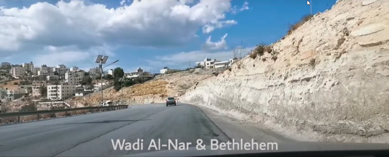
For a Palestinian holding a Palestinian Authority ID, today’s route from Bethlehem to Ramallah involves driving east of Jerusalem, around rather than through it, on bumpy back roads that wind through the villages and towns in the eastern suburbs. A driver has to first travel east of Bethlehem and use the treacherous Wadi al-Nar route, which was only recently renovated by the United States Agency for International Development (USAID) as an alternative route that connects Bethlehem to the eastern suburbs of Jerusalem. Taking this route often means risking one’s life up and down a dangerously steep road, especially in overcrowded busses and during the night.

Driving through the hazardous Valley of Fire, which now provides the sole connection for Palestinians between the southern and northern part of the occupied West Bank.

Source: 

Nomadic Facts

From Bethlehem, the route passes through the internal roads of five villages where traffic is the norm, before reaching the “Container” checkpoint (on the road that links Bethehem and al-‘Izariyya), which is unreliable and can close at any time for any amount of time. After that, the driver heads back to the northwest, driving through the often-jammed entrances of the Abu Dis and al-‘Izariyya road, which is unsafe for long-distance travel.

The driver then heads to the northeast again, into the Ma‘ale Adumim settlement area, and back again to the west of al-Za’im. At that point, the driver gets onto the infamous “Apartheid Road,” which is divided in the center by a wall (one side for yellow-plated (Israeli) cars, with access to off-exits directly into the city, the other for green-plated (Palestinian) cars, with no such egress).

Next, the driver heads north, crossing the Hizma checkpoint, and then proceeds on to the northeast of Ramallah and al-Bira, where he or she would reenter southward into Ramallah from there.

When tensions are high, more flying checkpoints could be set up by the Israeli military, prolonging the route. The trip can take from one to five hours depending on the conditions in each of these stations.

Needless to say, only the most critical reasons would merit venturing out for such a perilous, exhausting, and time-consuming trek.